


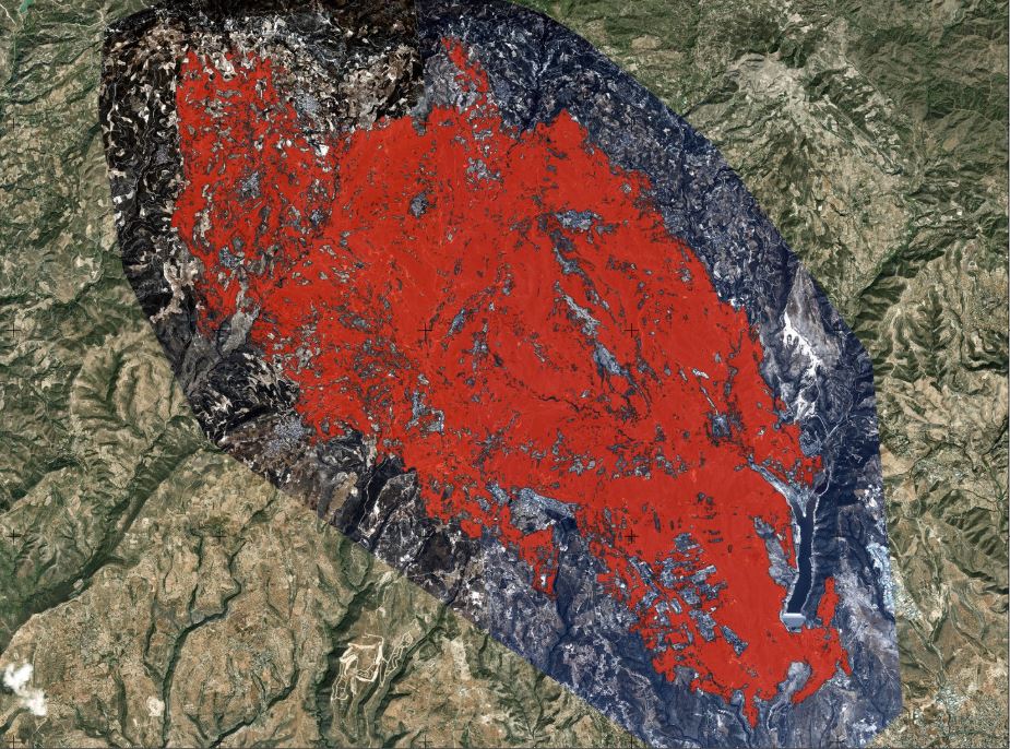
The final mapping of the areas affected by the recent wildfires has found that 104 square kilometres of land were burned , the Eratosthenes Centre of Excellence at the Cyprus University of Technology (Tepak) announced on Tuesday evening.
Using high-resolution, cloud-and smoke-free satellite images provided by the observation satellite constellation WorldView Legion , the analysis estimated the total burnt area at 104 square kilometers.
This is around 20 square kilometres


")